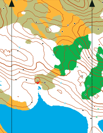
A very small part of the map
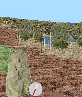
Part of the corresponding scene

by Graham Relf
www.grelf.net
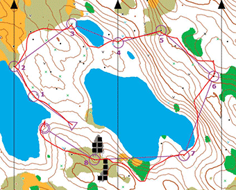
A route actually taken on the short easy course
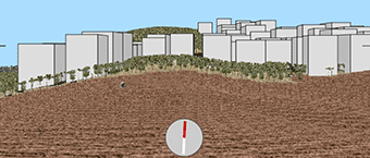
Buildings added 18.10.24
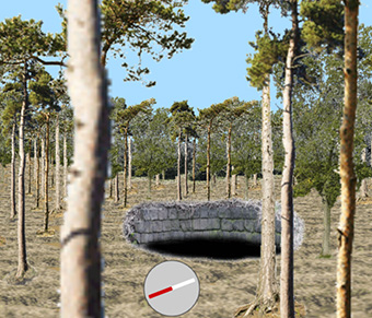
Non-orienteers can fall down into the mines
A very small part of the map
Part of the corresponding scene
by Graham Relf
www.grelf.net
A route actually taken on the short easy course
Buildings added 18.10.24
Non-orienteers can fall down into the mines
As a means of practising your map-reading skills you may like to try answering the following questions.
--- The first questions relate to the section of map that is visible when The Forest starts. The starting point for an observer on the ground is marked by a small red circle in the centre of the map, meaning "you (the observer) are here". The red circle is slightly pointed to indicate a facing direction (roughly due south at the start). You can always get back to this position by refreshing the web page. ---
1. How many mine shafts are marked on the initial portion of map?
--- The visible range is indicated on the map by a dashed red circle around the observer's position. ---
2. What types of vegetation can be seen within the initial visible range of 60 metres?
3. How many boulders lie within the initial visible range?
4. Given that the interval between contours represents 5 metres height difference, estimate the height in metres above lake level of the highest point within the initial visible range.
--- You can adjust the visible range by a drop-down list below the map and that can help you to measure distances. It is also worth noting that the black north lines are 300 metres apart. ---
5. What kind of terrain is at the spot 200 metres due east from the starting point?
6. From the starting point, what form does the nearest man-made object take?
(You will need to switch to the scene view, then come back to the map.
There are buttons for this below the map/scene.)
7. How many buildings are there in the nearest built-up (paved) area?
8. (a) What does the visible range need to be set to in order for it reach the nearest built-up area?
(b) If you do that, can you see the buildings? If not, why not?
9. South-east from the starting point, on the initial portion of map, there is a neck of land between
two lakes.
(a) What type of terrain is found there?
(b) What point features are marked there?
(c) Estimate the height of the highest point on this neck.
--- Lake surfaces are all at the same contour level in The Forest. ---
10. Just over 150m roughly due east from the starting point there is a mine shaft surrounded by a
contour. Does this contour indicate a slight rise or a slight dip in the ground?
You don't need to visit the scene, the map does indicate the answer. How?
--- Down below the map there is a line of text giving the position of the centre of the map. At the start it says "Map centre: x = 15321, y = 6068". This is like an Ordnance Survey grid reference. x is a distance in metres measured eastwards from a zero point and y is measured northwards. You can use this information to move the map to show any given (x, y) position. If you have a keyboard use arrow keys. Otherwise just inside an edge of the map click with a mouse or, on a touch screen, tap in order to move it. There are also buttons to enable you to move the map in bigger steps on each click. ---
11. The initial portion of map shows parts of several lakes. If you move the map to see the whole of those particular lakes, do they contain any islands?
--- In the explorer role you can usually jump to the position at the centre of the map by pressing the 'j' key (assuming you have a keyboard). ---
12. If you move east to the position shown here 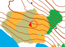 you will see a significant object on the ground which is not marked on the map. Why is it not marked?
13. At x = 0, y = 0 there is a large lake. Describe what can be found on each of the islands in this lake.
14. On the northeast side of the lake in the previous question the ground slopes up very steeply. (a) How can we tell it is steep? (b) Part way up this hill there is a significant hollow. Estimate the height in metres above lake level of the centre of this hollow.
15. Not far from the same lake there is a place where the contours and point features look like
this: 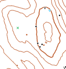 (on this map fragment the vegetation types have
been switched off). What are the approximate (x, y) coordinates of this place?
(on this map fragment the vegetation types have
been switched off). What are the approximate (x, y) coordinates of this place?
16. Notice that the tracks (dashed black lines) shown around the starting area do not have any steep sections because they roughly follow the contours. Estimate the height change between the southernmost and northernmost track ends.